 In a sign that Russia might not take an aggressively autonomous approach to staking its claim of the Arctic’s riches, it has been announced that Russia and Norway will work together to map the floor of the Barents Sea. The joint mapping project will begin later this month, according to a report by DN Energi.
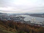
This is a positive sign, as the nations which border the Arctic need to reach a consensus at some point over how to divide the seabed. The Norway Post reports that Russia and Norway will map the uncharted underwater territory around the Svalbard archipelago as well as in the Barents Sea.
The Russian Geological Institute, the University of Oslo, and the Norwegian Petroleum Directorate will be participating in the mapping mission. A Russia research vessel, the Akademik Nikolay Strakhov, will conduct most of the geological surveying as the two nations look for gas and oil beneath the seabed.
Sissel Eriksen, the director of the Norwegian Petroleum Directorate, said that her agency has been working well with the Russians for some time now. The mapping venture is merely a continuation of their relationship. Eriksen emphasised that the primary task is charting the ocean floor, not just looking explicitly for oil and gas. However, her agency estimates that nearly 70 per cent of Norway’s undiscovered gas and oil resources are located in its far north.
See more at the Norway Post.
I knew it (in john wayne voice)…. Those sneaky Ruskies are up to no good.
– RRS – it is then OK that you pay out all you owe to Iceland – they need the money. ;-)
we owe both Iceland and Norway …. ahr ahr ahr ahr (Suomi doesn’t exist)
[…] will work together to map the floor of the Barents Sea. … Go here to read the rest: Norway teams up with Russia to map Barents Sea | IceNews – Daily News Share […]